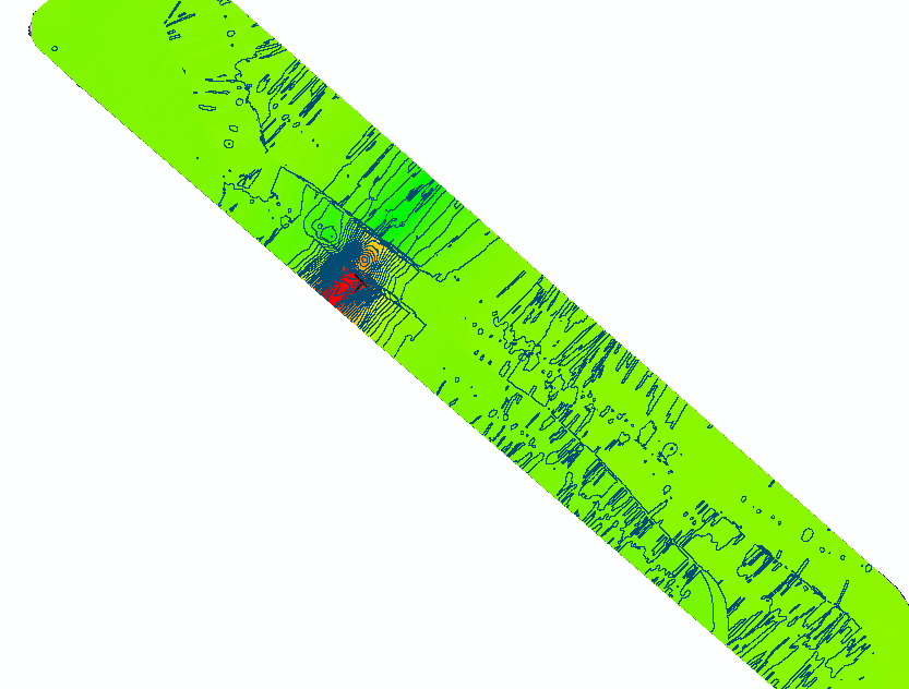
With the use of a Proton Precession Magnetometer (PPM),  Endurance Marine Exploration is able to is able to accurately measure the Total Earth Magnetic Field. We are then able to generate grid files with position, time, field strength in (nT), and other metrics. These files can then be imported into ArcGIS and post-processed with an archaeological magnetometer survey tool from the National Park Service and the Bureau of Ocean Energy Management which standardizes our results.
The final results are georeferenced magnetometer maps which can be used to locate areas where ferrous metals (iron or steel) are indicated to exist.